Our Services
Computer Generated Images (CGI)
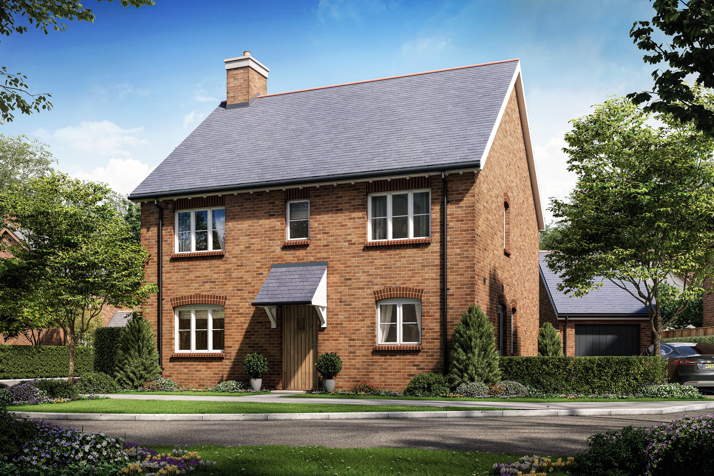
‘Architectural Visualisation’ can be thought of as a generic term for 3D visuals that communicate any aspect of a building’s design. These visuals generally come in the form of Computer Generated Images.
CGIs form the bulk of our work. They are images where the subject matter and the environment can be completely created within the computer. This is useful when little or no information is available on the surrounding area.
Information on the building usually comes in the form of CAD drawings. These can be stripped down and imported into the computer modelling software and used as a template for the 3D architectural model. Traditional drawings, sketches and photos can also be used to communicate the design.
Once the computer model has been created, materials are added to the individual 3D elements in accordance with the architect’s specification and draft images are sent to the architect for approval. These draft images can also be sent to the client (if not the architect) for discussion and approval of the final viewpoints.
High-resolution renders are then created from the chosen viewpoints and the final images are worked up adding digital artwork in Photoshop.

Photomontages
To create photomontages a 3D computer model of the building is constructed, but rather than placed into an artificial environment, the model can be superimposed into a photograph of the proposed site to make a photo-realistic visualisation.
Making a note of the time and location of the camera, the angle and lighting of the photograph can be replicated within the 3D environment. The computer images and real photography elements can then be blended together providing a more photo-realistic visualisation of the project once finished. Digital artwork can also be added to the final composition to enhance the final image.
Wherever possible, we suggest that a professional architectural photographer is used for the production of marketing images. The digital resolution they can offer far exceeds that of any ‘off the shelf’ cameras available from the high street.
We are happy to discuss various options for photography and if required, photographs can be supplied from the client, us, or if available, from stock photography (e.g. for aerial photomontages).

Architectural Animations
Architectural fly-through and walk-through animations can be created using the same 3D models that are constructed for the CGIs. They offer the viewer a virtual tour showing the internal and external aspects of the proposed scheme.
Through consultation with the client and design team, all the desired points of the scheme are listed. A storyboard or script is then drawn up showing how these items will be represented and the sequence in which they will appear in the final presentation.
Following the completion of the 3D model, draft animations can be generated for approval. These will provide an indication of the look and feel of the overall presentation. Should a narrative be required, the draft animations will provide the voice-over artist with the visual queues to enable synchronisation.
Animations can be generated at any size and in any format. These can be played on anything from a laptop or a plasma TV, all the way up to large format projectors.

Digital Editing
Photo editing is usually provided when the building already exists but requires altering in some way.
It may be from as simple as adding a few people or putting up a new sign, through to changing the interiors or a complete facelift for a photorealistic finish.
Work on the original photograph can also be undertaken to provide better lighting, colour and contrast resulting in a more ‘polished’ finish.

Verified Views (VVM & AVR)
Verified Views, also known as Verified View Montages (VVM) and Accurate View Representations (AVR), are the most accurate of all the methods for producing planning images.
All data used to construct the images is meticulously recorded and presented with the images in a Methodolgy Statement. This method is often used to help resolve sensitive planning issues in built up areas.
For this method, a survey team using GPRS equipment can reference the camera location in a similar way to the O/S images. However, rather than using the old O/S grid, it now uses the new digital O/S grid, giving incredibly accurate information.
To further increase the accuracy, a laser is fired from the camera tripod at certain visual points that will be seen in the photo. These points can be items such as the corner of a window, top of a lamppost or even the corner of a road marking. For every point, X, Y and Z coordinates are provided, again all recorded and referenced back to the digital O/S grid. By placing a ball in the model to represent each of these points and having the relevant photograph as the background image in the computer model, the camera alignment within the model is greatly improved.
For more information on Verified Views and for a more detailed description of the process, please do not hesitate to contact us.

VR Tours
We offer both types of VR products; interactive 360 panoramic tours and fully immersive virtual reality environments.
Both these solutions allow potential customers and clients to explore the property via the internet through a headset, mobile device or desktop/laptop.